
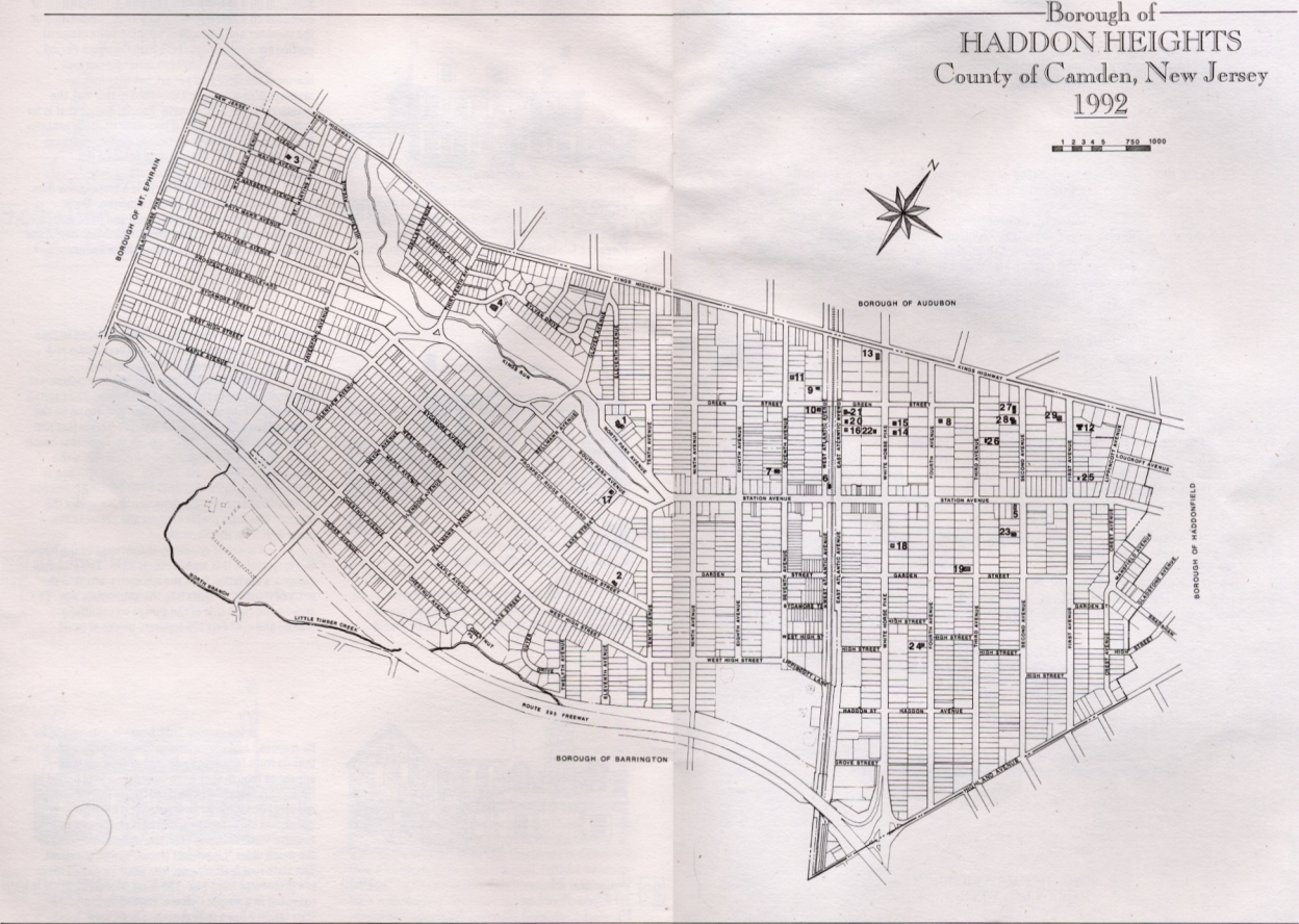
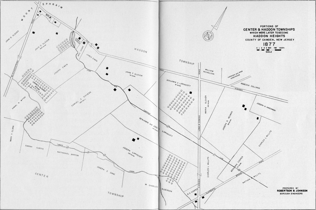
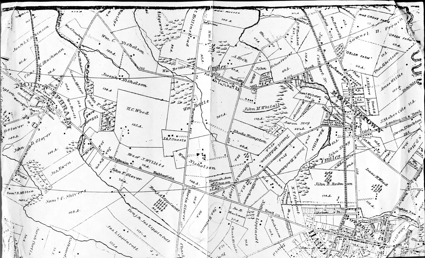
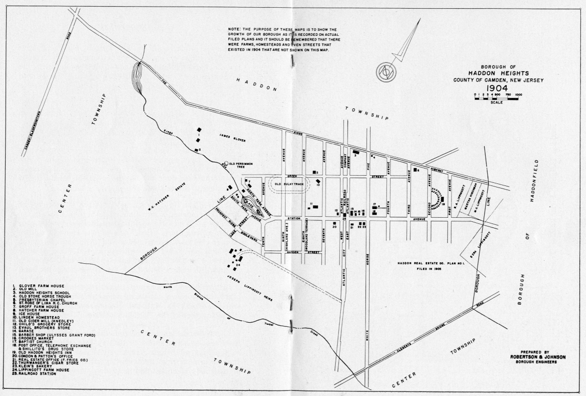
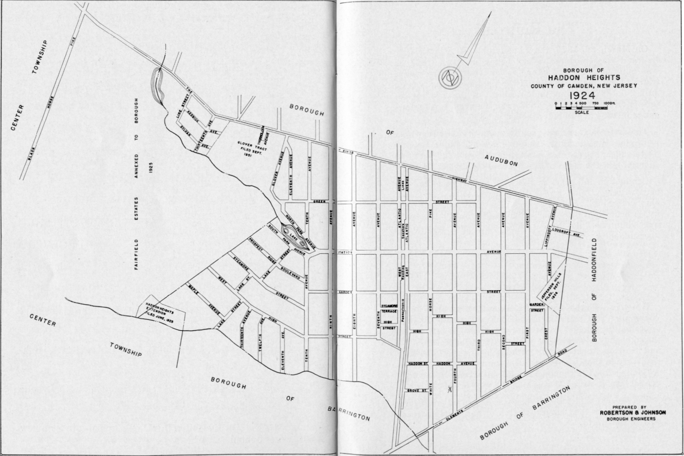
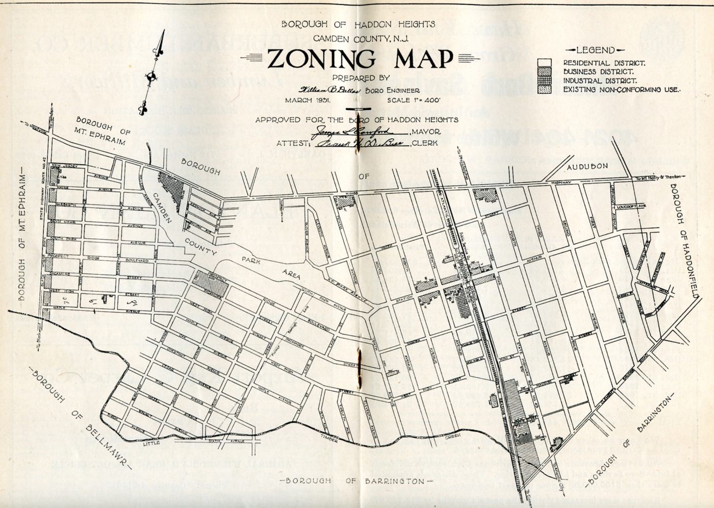

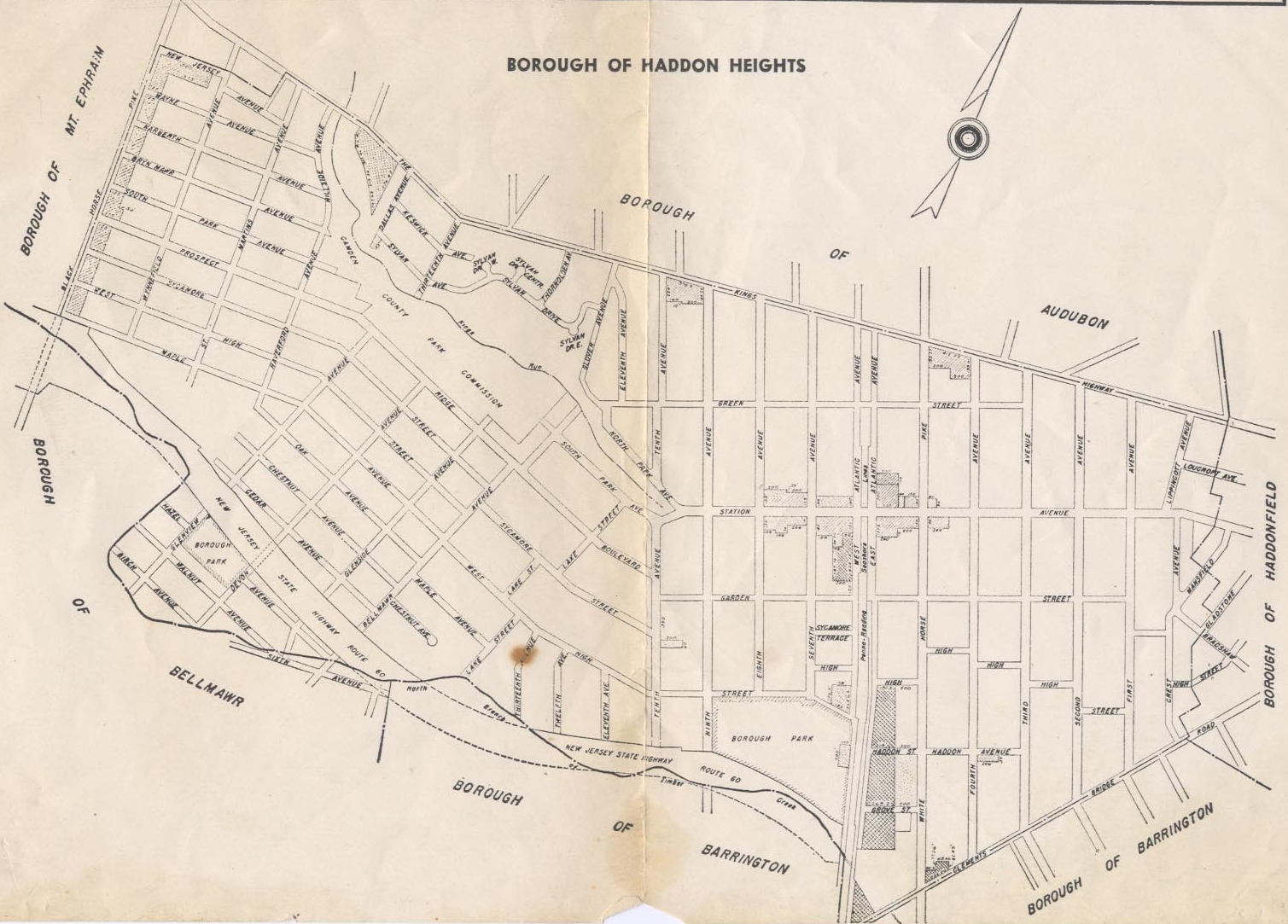
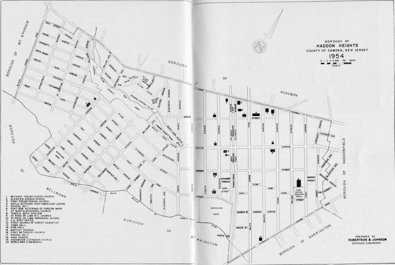
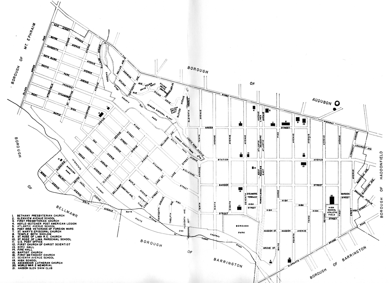
In addition to the above Haddon Heights Borough maps, Princeton University’s Historic Maps Collection includes an extensive set of Sanborn Insurance Maps (1884-1950) for hundreds of New Jersey communities (now digitized and viewable online at http://www.princeton.edu/~rbsc/department/maps/. Current digitized maps for Haddon Heights include 1909, 1914, 1922, 1924 and 1927.
Continue exploring
In this collection
Open an image to inspect the full-resolution map.